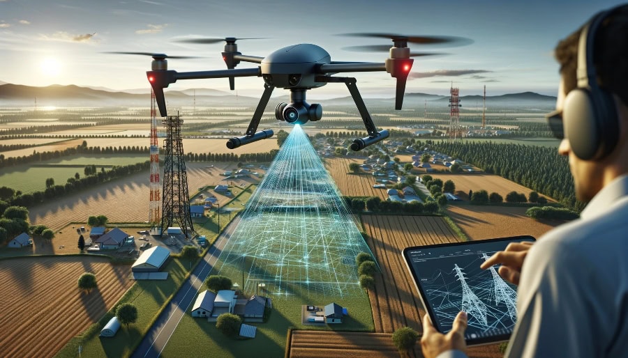
Lidars
LiDAR stands for Light Detection and Ranging. It works by emitting laser light from a transmitter, which then bounces off objects in its environment. The system’s receiver captures the reflected light, and by measuring the time it takes for the light to return (known as the time of flight, or TOF), a distance map of the surrounding objects is generated.

LiDAR is an optical technology frequently regarded as a crucial tool for distance sensing in autonomous vehicles. Numerous manufacturers are striving to create compact and affordable LiDAR systems. Nearly all companies involved in the development of autonomous driving view LiDAR as a fundamental technology, and some systems are already being integrated into Advanced Driver Assistance Systems (ADAS).
How Does LiDAR Operate and What Solutions Does It Offer?
LiDAR is fundamentally a distance-measuring device, which calculates the distance to a target. It does so by emitting a brief laser pulse and recording the time it takes for the reflected (back-scattered) light pulse to return, allowing it to accurately determine the distance to the object.
A LiDAR system may utilize a scanning mirror, multiple laser beams, or other techniques to “scan” the object space. Its precise distance-measuring capability allows LiDAR to address a wide range of challenges.
In remote sensing, LiDAR is employed to measure the scattering, absorption, or re-emission of light by particles or molecules in the atmosphere. To achieve this, the system’s laser beams may need to be set to specific wavelengths. For instance, LiDAR can measure the concentration of specific molecules in the atmosphere, such as methane, or detect aerosol levels. It can also measure rain droplets, helping to estimate the distance of a storm and the rate of rainfall.
Some LiDAR systems map three-dimensional surfaces within an environment. In these cases, the laser beams are not tuned to specific spectral features, but instead, the wavelengths are selected for purposes like eye safety or avoiding atmospheric interference. The beam reflects off a “hard target” and returns to the LiDAR receiver, enabling accurate surface profiling.
LiDAR is also capable of measuring target velocity, either by utilizing the Doppler effect or by calculating the distance to an object repeatedly in quick succession. This enables measurements like wind velocity or the speed of an automobile.
Moreover, LiDAR can generate a three-dimensional model of dynamic environments, such as those encountered by autonomous vehicles. This is typically achieved through various scanning methods.

What are the Challenges with LiDAR?
LiDAR is fundamentally a device used for measuring distances to a target. It operates by emitting a brief laser pulse and recording the time it takes for the reflected (back-scattered) pulse to return, allowing it to calculate the distance.
However, operational LiDAR systems face several well-known challenges, which can vary based on the type of system in use. Here are a few examples:
- Isolation and Rejection of Signal from the Emitted Beam – The radiance of the emitted laser beam is typically much stronger than the reflected return signal. Care must be taken to ensure that the probing beam is not reflected back into the receiver, as this could saturate the detector and prevent the detection of external targets.
- Spurious Returns from Debris in the Atmosphere – Debris between the transmitter and the target can create strong, unintended returns, which can interfere with the system’s ability to detect the intended target reliably.
- Limitations on Available Optical Power – While increasing the optical power of the beam enhances measurement accuracy, it also raises operational costs. More powerful systems are typically more expensive.
- Scanning Speed and Safety – Operating the laser at frequencies harmful to human eyes poses a safety risk. Solutions like flash LiDAR, which illuminates a large area simultaneously, or operating at eye-safe wavelengths, are helping to mitigate this concern.
- Device Crosstalk – Signals from nearby LiDAR devices can interfere with the system’s intended signal. Current efforts include developing techniques such as signal chirping and isolation to differentiate between signals from multiple LiDAR systems.
- Cost and Maintenance – LiDAR systems are generally more expensive than alternative sensor types, but there is ongoing development aimed at reducing costs to make these systems more affordable for widespread use.
- Rejection of Unintended Returns – Similar to the challenge of atmospheric spurious signals, unintended returns can also occur in clear air. Solutions typically involve narrowing the beam size at different distances and fine-tuning the field-of-view received back at the LiDAR receiver to minimize interference.
